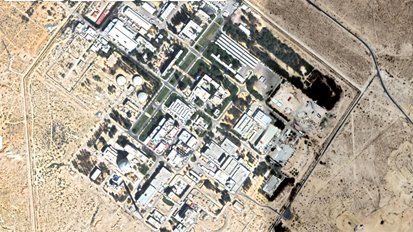
Commercial satellites now show high-resolution images of Israel's nuclear reactor

Imaging of Israeli military installations are now available on Google Earth and other online map services after Trump reversed existing law banning unpixellated photos of bases, reactor in Dimona; officials fear images could be used by enemy forces
Daniel Salami|
Getting your Trinity Audio player ready...
Commercial satellites now show high-resolution images of Israel's nuclear reactor as well as other security installation after a U.S. change in policy on telecommunications imaging.
  • Follow Ynetnews on Facebook and Twitter

  • As of Thursday, Google Earth and other online map services show photos of the nuclear facility in the city of Dimona in the Negev Desert with an option to alter dimensions to improve photo resolutions and see the installations from up close.
    3 View gallery
    הכור הגרעיני בגוגל מפות
    הכור הגרעיני בגוגל מפות
    Satellite images of the nuclear facility in the Negev
    (Photo: Google Maps)
    The change in the online map services' policy came after former U.S. President Donald Trump had ordered to lift restrictions on American-owned satellite imaging - an order that came into effect last summer and reversed a 1997 law lobbied by Israel to protect its military bases.
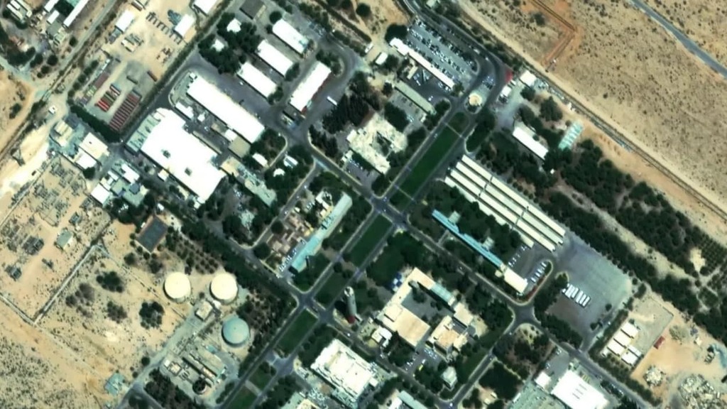
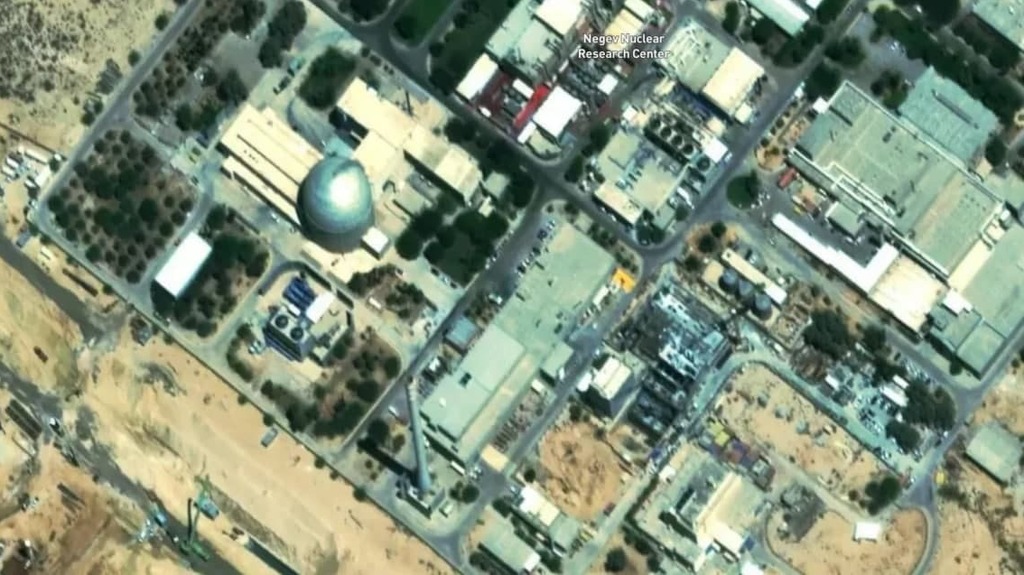
    For instance, on Mapbox, a free access website, the Dimona reactor and other major military installations no longer appear pixelated and can now be seen at a 4.0 resolution, double the 2.0 resolution that was allowed previously.
    Israel's military censor did not prevent publication of the images and their availability, although among the military installations open to scrutiny are major air bases where Israel Air Force's helicopters are clearly visible.
    3 View gallery
    הכור בדימונה
    הכור בדימונה
    Satellite images of the nuclear facility in the Negev
    (Photo: Mapbox Satellite Streets)
    The Associated Press posted satellite images of the Dimona reactor last February, which were provided by PlantLabs, posted in a resolution of 0.5, just short of the best available resolution.
    The images posted by Mapbox are similar to those published by the Associated Press.
    Head of Space Program at the Defense Ministry Amnon Harari said he did not believe Israel was consulted in advance before the federal order came into effect and its military bases and nuclear facility were thus exposed.
    "We always prefer satellite photos of Israel be in as low a resolution as possible," he said.
    3 View gallery
    הכור בדימונה
    הכור בדימונה
    Satellite images of the nuclear facility in the Negev
    (Photo: Mapbox Satellite Streets)
    In a report last year, the Reuters news agency reported Israel was concerned that the Lebanese based, Iran-backed terror group Hezbollah would use the satellite images to prepare attacks against Israel.
    7Comments
    add comment
    The commenter agrees to the privacy policy of Ynet News and agrees not to submit comments that violate the terms of use, including incitement, libel and expressions that exceed the accepted norms of freedom of speech.
    5.
    CEO
    Google has managed to strip bare any private locations and expose even the most sensitive lands. Most homes in America are also online without the owners knowledge or permission.
    C. McIntyre| 10.30.21
    10
    add comment
    The commenter agrees to the privacy policy of Ynet News and agrees not to submit comments that violate the terms of use, including incitement, libel and expressions that exceed the accepted norms of freedom of speech.
    4.
    WHAT IS GOING ON ?
    A reliable satellite photo of the secret Dimona Nuclear Reactor and there is no sign of a McDonalds or a KFC or a 7-Eleven . How do the many workers there cope ?
    Mr Cynic| 10.29.21
    21
    add comment
    The commenter agrees to the privacy policy of Ynet News and agrees not to submit comments that violate the terms of use, including incitement, libel and expressions that exceed the accepted norms of freedom of speech.
    3.
    Google is a terrorist spy satellite
    Whilst national governments might have always had the capability to see the reactor complex in detail terrorists have not and that has limited their ability to carry out things like rocket attacks. Give them detailed knowledge of exactly what they have to hit they will do it so now thanks to Google terrorists now have the same spy satellite capability once only national governments had access to. Its also time for Israel to close the reactor anyway considering the fact its now its nearly 60 years old. Iran doesn't need a nuclear weapon, all they need to do is get Hezbollah to fire a couple of rockets at the reactor and radioactive fallout all of Israel and many other countries in the region would become uninhabie. I also doubt the place is earthquake proof and Israel is due a big one.
    zionist forever| 10.29.21
    03
    add comment
    The commenter agrees to the privacy policy of Ynet News and agrees not to submit comments that violate the terms of use, including incitement, libel and expressions that exceed the accepted norms of freedom of speech.
    Load more talkbacks
    ""