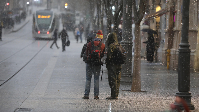
Snow began to fall in Jerusalem and on the mountains of central Israel on Wednesday evening. The heavy snow will continue to fall in the capital throughout Wednesday night and is expected to stick on the ground, according to the Meteorological Service.
Rain showers and strong desert winds accompanied by thunderstorms and hail were expected to spread Wednesday night from northern Israel down to the northern Negev Desert. There was a chance of flooding in lower regions, and winds were set to reach speeds of up to 100 km per hour.
Snow has already been falling in Israel's mountainous north, in the Galilee and on the Golan Heights, where torrential rain and hail stranded some cars and turned streets into rivers of mud.
In the West Bank, snow will first reach the mountains in the north and spread down to the Gush Etzion and Hebron area. These areas are expected to see up to 10 centimeters of snow.
On the Golan Heights, vehicles were placed at the main intersections to block traffic during the snowfall in order to allow the plows easy passage and to prevent accidents.
Police urged the public to use caution when driving in snowy conditions and to avoid unnecessary travel.
The storms are expected to taper off, but temperatures will remain unseasonably low, and local rain showers are expected.
Dusty winds whipped through the West Bank as well. In Cairo, winds reached over 50 kilometers per hour (30 mph), bending palm trees along the Nile River, while in Libya rain, wind and cold weather was driving increased demand for electricity that overloaded the electricity grids and led to power outages.
Meanwhile, in Gaza, fishermen returned to port and docked their boats to protect against the stormy sea.
Sandstorms are common in the region in late winter and early spring and Egypt's Meteorological Commission urged caution but did not advise anyone to change their daily routines.
The Associated Press contributed to this report.


