Getting your Trinity Audio player ready...
Dr. Richard Umansky studied medicine in Ohio and had his pediatric residency in Japan. From there he moved to Oakland, California, but the vagabond within him wouldn't let him be. Every year, he'd travel to some faraway location to broaden his global perspective and collect ancient maps.
He had a keen eye for cartography and could easily spot a genuine map and a fake from a skillful charlatan.
4 View gallery


A map of Israel by Reverend Heinrich Binting
(Photo: Haifa University, Umansky collection)
For decades, he's collected old 16th and 17th-century maps, studied them thoroughly and then handed them to California's Stanford University for cataloging.
This rare collection aided researchers from all over the world who wished to expand their knowledge on the Roman Empire, the wonders of Mesopotamia and the Israelites' voyage through the desert toward the promised land.
His only condition to Stanford was that upon his demise, his collection would be handed over in its entirety to Haifa University. A few months ago, Stanford did just that.
"We're delighted," says Dr. Tzur Shalev from Haifa University. "It was 20 years ago that I wrote an essay about two of these maps, and now they're actually here."
Dr. Shalev is studying how Christian scholars interpreted ancient Hebrew geographical texts, which make their historical maps of modern-day Israel priceless. "We have maps from German reverend Heinrich Binting, who drew many beautiful maps from the time of the Canaanite people, a Semitic-speaking civilization.
"Binting compiled biblical accounts into a collection of travels. This 16th-century man managed to document long distances in voyages with zero advanced equipment to aid him while explaining the spiritual meaning of Abraham and John the Baptist."
In Binting's map, Mount Tavor looks like the Middle East version of Everest. "His book received wide acclaim all over the Christian world and was translated into many languages. Now we have his maps here in Israel."
4 View gallery


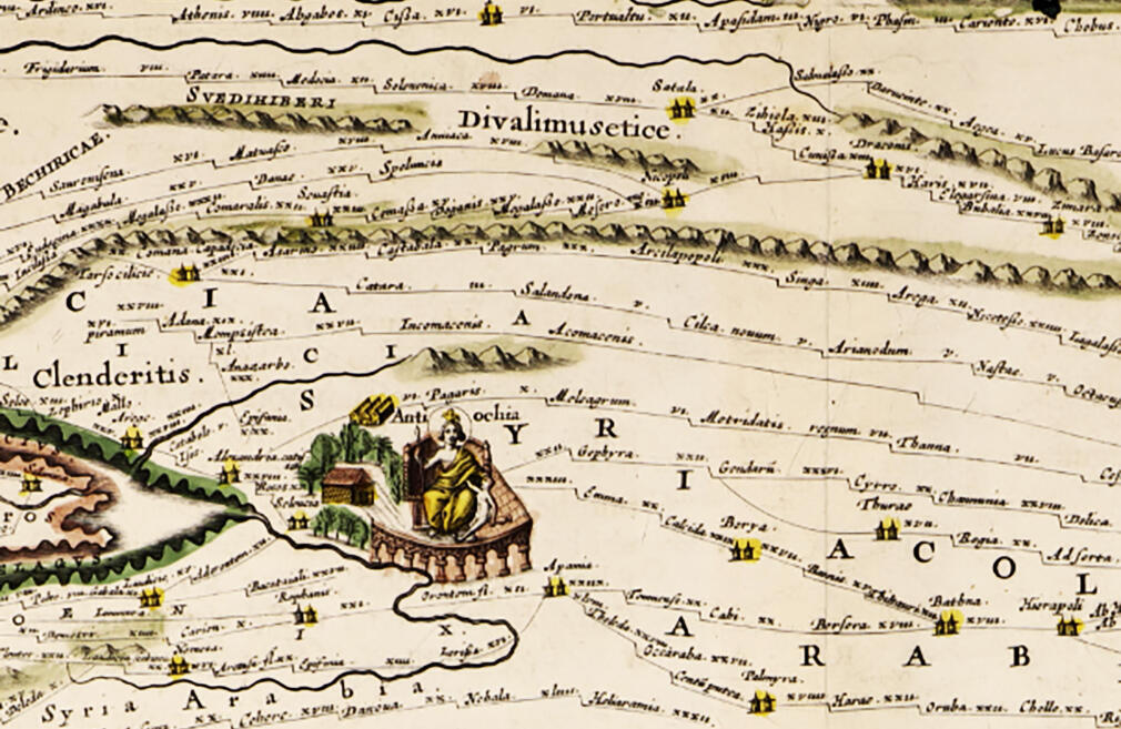
A Roman pathway map, somewhat distorting fidelity of distance but tells a story of its own
(Photo: Haifa University, Umansky collection)
From a scientific standpoint, the 16th and 17th centuries were a transitional period for the world. The advent of print, the discovery of the Americas. Those create a sort of renaissance with atlas maps and journals of voyages that discovered parts of the world previously unknown.
"Despite previous acquaintance with various parts of the world," Dr. Shalev says, "maps back then were drawn from the perspective of biblical interpretations rather than physical presence in the drawn location. A cartographer is expected to go into the field and draw based on his voyage.
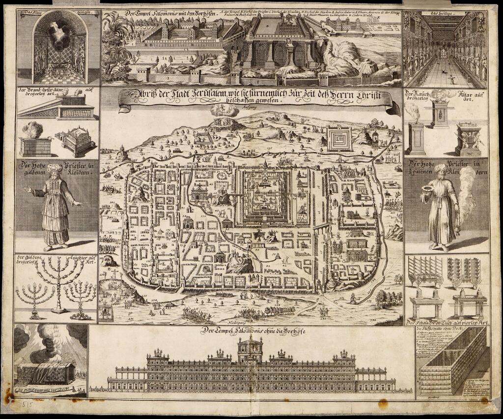
"The traditional perception of space was nullified by new geographical discoveries. A 17th-century map of Jerusalem, drawn from a biblical outlook, did not even include Temple Mount. Their understanding of the city was obsolete."
Those were drawn by a Catholic scholar that relied on descriptions from the bible and medieval pilgrims. Solomon's Temple looks like a European palace surrounded by walls, which was a far cry from what it actually looked like in reality.
4 View gallery


A 17th-century map of ancient Jerusalem
(Photo: Haifa University, Umansky collection)
One particularly fascinating map was a 17th-century Dutch interpretation of a 13th-century original, which details roads crisscrossing the Roman Empire. Fidelity of distance is highly inaccurate because it doesn't document factual information but rather romanticized visions of roads and resting locations throughout.
Haifa University is very excited to land such a unique and historical collection that encapsulates, in its own way, the patterns of thinking of the medieval world and how they evolved through different periods of the European enlightenment.
"The Umansky collection has copies in different locations around the world," The University says. "But we see a huge advantage for our researchers to work with original findings of immense historical significance, such as 500-year-old maps, drawn with ancient equipment. History oozes from every document. We invite the public to Haifa, come and discover the excitement."


