Getting your Trinity Audio player ready...
Whether you have an Android phone or an iPhone, it is extremely unlikely that you haven't utilized Google Maps even once. It is by far the most commonly used app for getting around, and many people use it exclusively to plan their vacations.
So it is of note that on Wednesday, Google launched three AI-based features for Google Maps which now includes an aerial and quite immersive display of 500 tourist attractions around the world, as well as the option to navigate directly from your smartphone's lock screen.
Additionally, there's a notable improvement with regard to planning a trip or a specific route you're about to take, including saving multiple routes and comparing them for distance, elevation and more. These improvements are all part of a new AI-based approach that was uncovered at Google's latest conference in Paris.
It would be at least somewhat inaccurate to say that Google has just discovered the avenues in which artificial intelligence can improve the functionality of smartphones, as this is a course of action Google has been utilizing for years.
The fact of the matter is we've been taking many of those already implemented features for granted, such as the ability to identify faces in the pictures we store on our phones, or planning various routes on our maps.
Either way, these newly implemented improvements are designed to make it easier for hikers and travelers in the upcoming summer months. As we all know, summer is notorious for being the most traveled season of Them all.
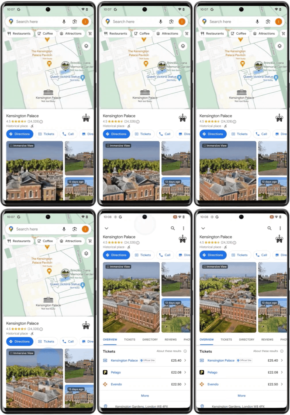
So let's focus on the first feature called immersive view. As mentioned, it contains an aerial display of 500 notable tourist excursions around the world, complete with real-time information about the weather and how densely packed the location is at the moment.
Fancy a visit to the Kensington Castle in the UK? Just hover yourself right over and receive the necessary information prior to making the decision on whether or not you wish to actually go through with it.
Additionally, you can take a peek inside restaurants and cafes all around that area to decide if you wish to reserve a table ahead of time. Obviously, this feature won't be available in every city around the world, but some exquisite tourist attractions are included, such as Amsterdam, Dublin, Venice and Florence. Stunning cities without a shadow of a doubt.
The second is called Glanceable directions, which allow you to plan your route both on the fly and with regard to locations you had planned ahead of time, including directly from your lock screen or from the point where you are observing the route within the app.
You'll be able to assess accurate times of arrival and where exactly you need to turn in order to remain on that route, all in real-time. Should you decide to deviate from your pre-planned path, the app will update your route automatically. This feature will be launched worldwide and will include routes for hiking, biking, and driving, both on Android and iPhone.
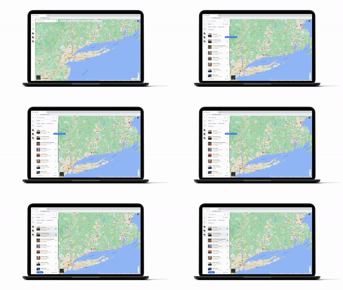
The third feature is designated for pros who love to optimize their routes. And currently, it is only available on your PC or Mac. It is called recent highlights, and it provides a small window with all of the sites and locales that you have searched for in the past.
These will automatically appear on a list on the side of the screen. It is designed to facilitate an easier planning stage as well as keep track of all the locations you wish to visit, especially if your route is a multi-city affair.
Fear not, though, as locations are saved even after you close the Google Maps window, and you can come back to it later without having it misplaced.
Additionally, you can toy around with your list, remove certain locations, plan multiple routes simultaneously and share all of that with your travel partners so they can provide their input on specific locations such as restaurants or hotels.
To operate these features, choose at least three locations and ask for path instructions, at which point Google Maps will automatically manufacture a path that will be specifically designed to go through all of the locations that you have designated.


