Getting your Trinity Audio player ready...
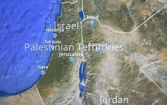
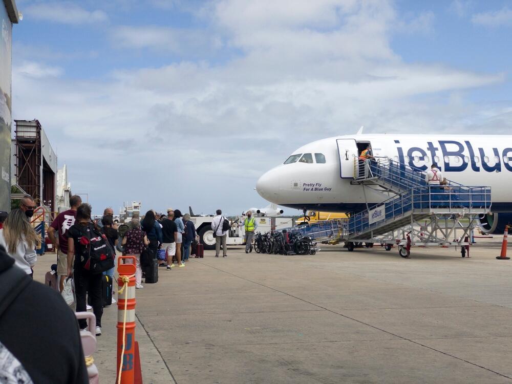
Jetblue Airlines uses a map on its flights, showing Israel as 'Palestinian Territories' with the Golan Heights no longer included within the border. After passengers complained, the company has yet to apologize and hasn't changed the map.
Following recent political activism on flights worldwide, passengers wonder if this was a mistake or a new perspective on Israel's borders. JetBlue responded that the map service was provided by a third party and are now trying to understand where the map originated.
In their response, the company chose to blame the external service provider instead of apologizing or explaining the choice to present Israel's borders differently. But social media users did not remain indifferent to the affair. "Why not take a basic geography lesson first, instead of dealing with unknown service providers?" one critic asked. Another user suggested Jetblue check an actual map before posting content.
Some joked and compared JetBlue's mistake to the map from Prime Minister Benjamin Netanyahu's presentation on Wednesday, which did not include the West Bank. One of them wrote: "To be fair to JetBlue - even the prime minister of Israel himself is not entirely sure what the borders of his country are."
The map is still being displayed on flights, and JetBlue has not clarified whether it will change it or leave it on display.
This is not the company's first such controversy. In April, it officially announced that it would change its procedures following an incident in which a Jewish passenger from Florida complained about a Free Palestine pin on a flight attendant's uniform, which resulted in his being ousted from his flight.
Eventually, the company apologized and said it would change the existing policy that allows flight attendants to wear private pins to "reflect the current environment." The company added that it reached out to the Jewish passenger and apologized for the disruption to his JetBlue flight. "We hope with these actions we can welcome him back onto a JetBlue flight in the future," the company said.
In answer to Ynet's question, the company said that a number of other airlines around the world use the same map software, which is provided by an outside source, on their seatback screens.
"We don’t believe the provider has made updates or changes to the map recently. The concern reported about the font size seems to be related to when a user zooms into the map on an area that is small in size. When zooming into smaller countries and cities, the font labels increase disproportionately to the land. This is how the technology works on all areas of the globe and it does not appear to be an intentional choice or statement about Israel."
They went on to say: "The map app is primarily meant to see where your aircraft is flying, and JetBlue does not fly to Israel or the Middle East. To that end, we have not previously reviewed the map app’s functionality in that region. We’ve reached out to our service provider to get more information about the map’s functionality and accuracy."


